
The Case of Lisbon
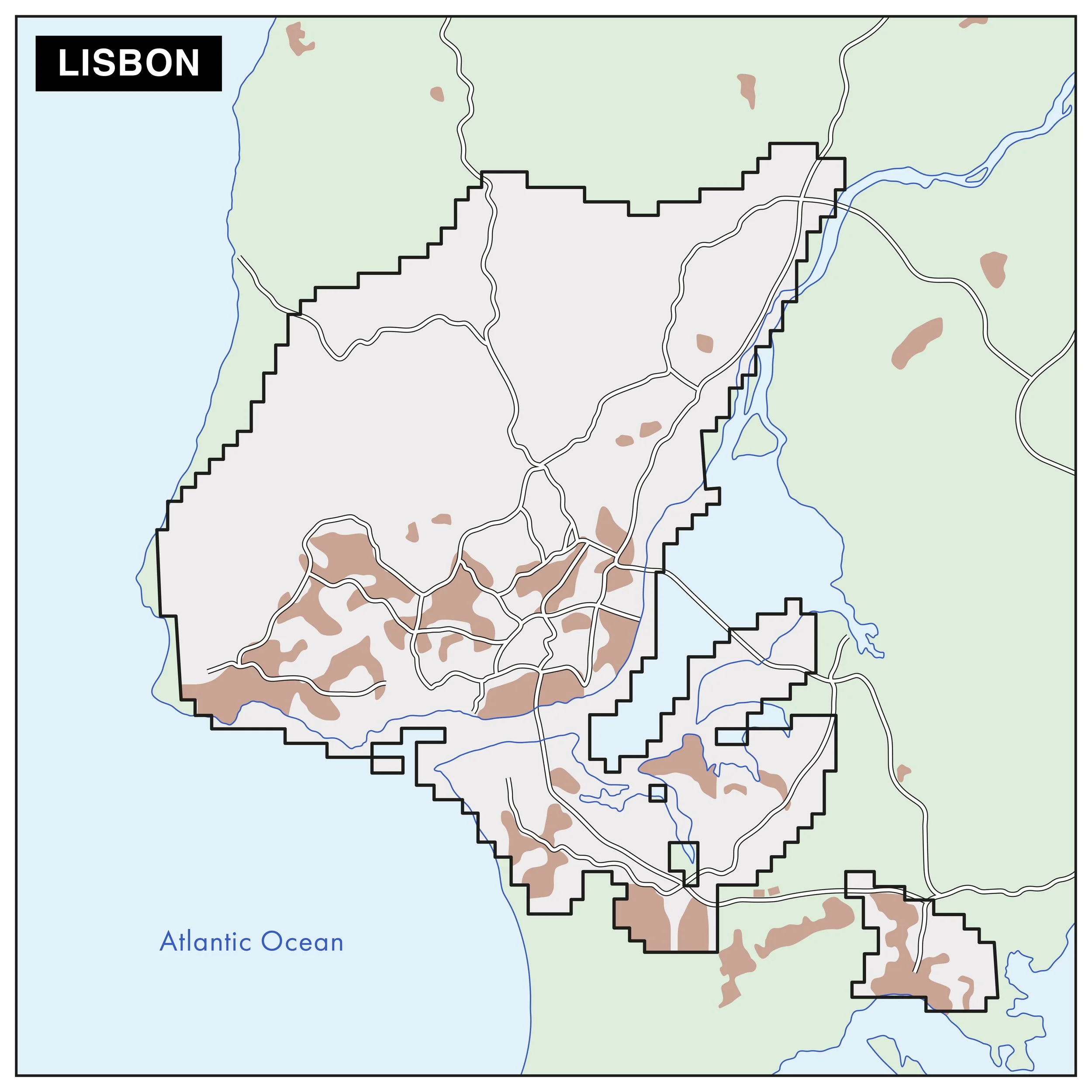
The functional urban area (FUA) of the Case Study in Lisbon
Lisbon is Portugal's most populous and dynamic urban center. The city is characterized by a dense urban fabric of high historical value and most of the region’s financial activity, administrative institutions and tourism. Lisbon’s central area is densely built and has few green areas, making it more susceptible to the effects of extreme heat. The wider FUA extends beyond the administrative boundaries of the city of Lisbon and comprises part of the complex network of urban, peri-urban, rural, riverside and coastal areas of the Lisbon Metropolitan Area. The Lisbon Metropolitan Area is made up of 18 municipalities and a population of around 2.8 million inhabitants, representing around 28% of Portugal's population.
Today, Lisbon faces interconnected sustainability challenges related to urban sprawl and land occupation, which continues to put pressure on natural and agricultural spaces. According to the Lisbon Metropolitan Area Adaptation Plan, the region is currently facing a combination of extreme heat events, flash floods, coastal overflows and increased frequency of droughts, and the most vulnerable areas are those along the Tagus estuary, the inland valleys and densely populated urban centers. For 2030 and beyond, the region expects to see an increase in the frequency and intensity of heat waves, rising sea levels, prolonged droughts and intensified urban and coastal flooding.
I personally really like the idea of thinking or dreaming or imagining possible futures. And if we didn't believe that yes, something different is possible, a different development model, we would have gotten into this because social activism, and now also political activism, requires such intense and voluntary work, without any remuneration, that if we weren't firmly convinced that yes, it is possible, we wouldn't be carrying out this work.

Three examples of nature-based solutions in Lisbon
URBEM is a volunteer environmental NGO based in Lisbon and it was launched in 2021 with a project on a hillside located in Vale da Montanha Park (Lisbon), a 300m² area provided by Lisbon City Council. Inspired by the Miyawaki Method, and with some key participants related to other projects like FCULresta, the NGO works closely with communities, municipalities and research institutions around Lisbon.
The ReDuna Project is located in Almada, Portugal. The project is aimed at restoring and protecting the coastal dune ecosystem of São João da Caparica in response to the damage done by Storm Christina in 2014. The storm caused extensive coastal erosion and harm to the ecosystem, underlining the vulnerability of the coastline. The project utilized sand fences, native plant restoration and sediment retention techniques to rebuild the dunes, using seeds collected from local sources to maintain genetic integrity.
Lisbon's Green Corridors Network is a central element of the city's urban and environmental planning, aimed at integrating ecological connectivity, climate resilience and urban well-being. The network is made up of nine green corridors that seek to reconcile urban growth with ecological restoration, promoting sustainable mobility and the preservation of natural and cultural heritage. Among them, the Alcântara Valley Structuring Corridor is a response to the historical inequalities in the organization of Lisbon's urban territory.

Figure 1: Urbem Fast Forest. Photo source: Andresa Lêdo Marques

Figure 2: ReDuna Project. Photo source: Andresa Lêdo Marques
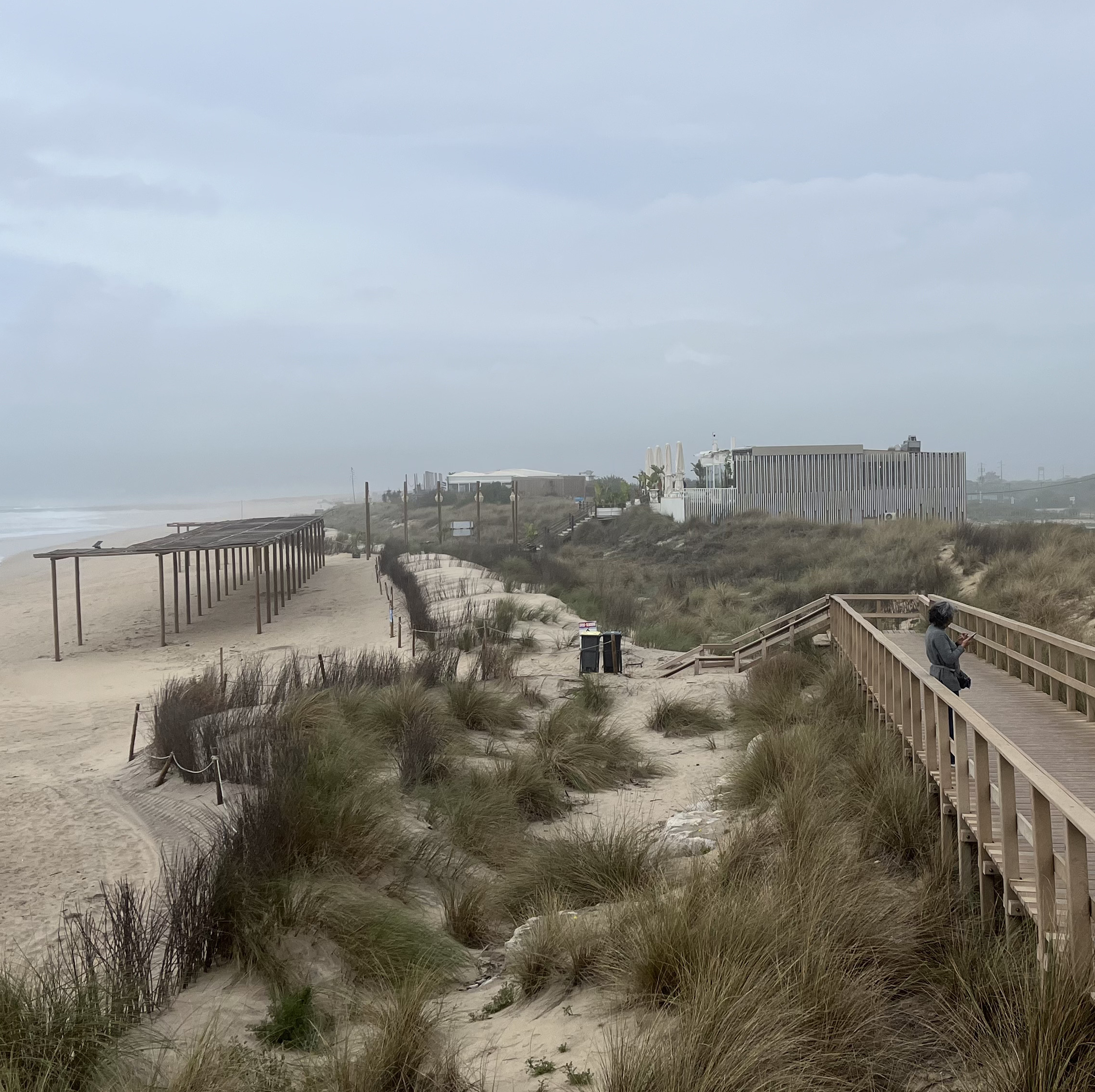
Figure 3: Alcântara Valley Structuring Green Corridor. Photo source: Andresa Lêdo Marques